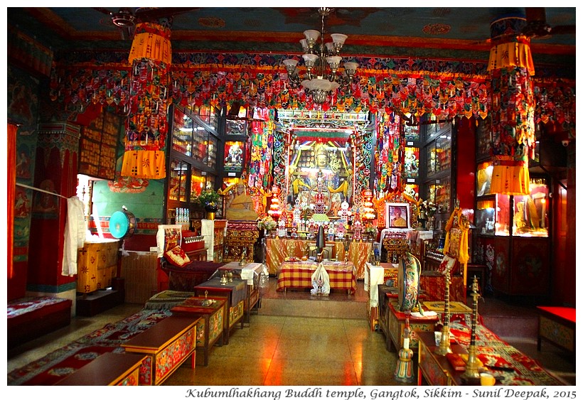
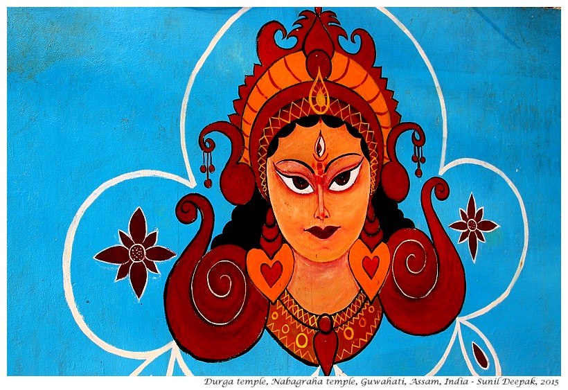
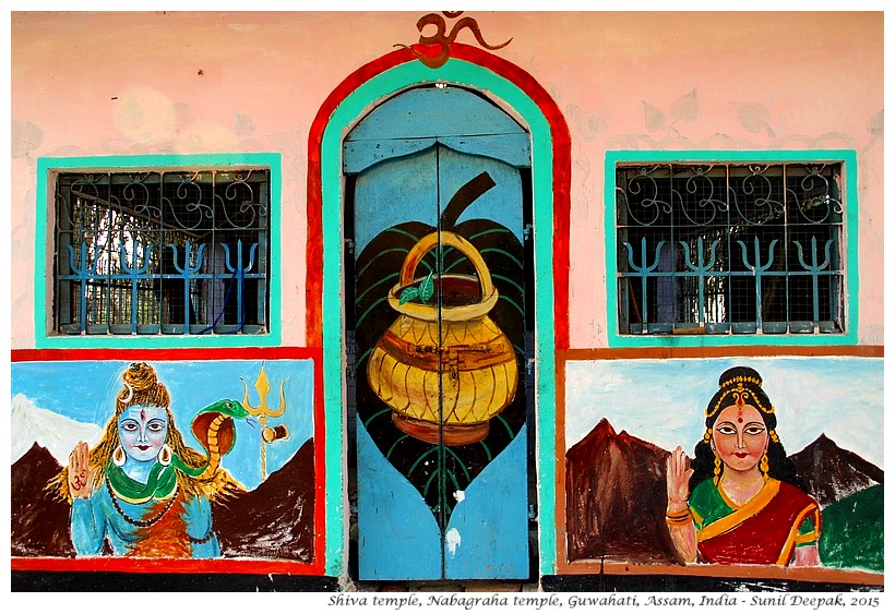
The image below shows a painting on the Durga temple that is part of the Nabagraha temple complex on the Chitrasal hill that you can visit on this walk.
INTRODUCTION
The area around Guwahati in the plains of the Brahmaputra valley has been inhabited since prehistoric times. It had always been of strategic importance as the river port connecting the Brahmaputra valley in the east with the Gangetic plains to the west.
Yet, in spite being an important commercial hub, in the recent history Guwahati did not become the capital of any important regional kingdom for a significant period of time. Thus, you do not find any important heritage buildings of medieval or British colonial periods in Guwahati. However, you do find many important heritage temples in Guwahati.
Guwahati is located in a region known as Kamrup. The legends of Kamadev, the Hindu god of love, are linked to the Neelachal hill near the river in the south of the city. A pillar inscription in Allahabad from 4th century mentions two ancient kingdoms in this region – Kamrup and Davak. Later the Kamrup kingdom had absorbed the Davak kingdom.
In ancient times Guwahati, was known as Pragjyotishpura, or the "city of astrology". The ruins of the Ambari from the ancient Pragjyotishpura, dating back to 8th-9th century, can be visited at the archeology institute of Guwahati in Uzanbazar, not very far from Silpukhuri.
Ahoms, a Tai group, became dominant in the 13th century and created its kingdom in Upper Assam. The Ahom kingdom gradually expanded and lasted till early 19th century. Till the 17th century, the Ahom kingdom was still very strong. For example, the Mughal forces tried many times to enter Assam but were defeated by the Ahoms. The last Mughal invasion was in 1682.
However by early 19th century, the Ahom kingdom had become weaker. Burmese invasions between 1817 and 1825 ended the Ahom reign and the region came under the Burmese rule for a short period. The Anglo-Burmese war in 1826 brought Assam under the rule of the East India company.
Initially the British presence in Assam was marginal. However, the discovery of the tea plant (Camellia assamica) in Assam and the ending of a trade agreement between the British and the Chinese for the import of tea into Europe during the 1830s, changed everything. The British decided to set up tea plantations in Assam. Gradually during 19th century, East India company and the British colonial rule expanded their presence in the north-east, creating tea plantations in the Brahmaputra and Barak valleys. For a brief period Guwahati (at that time called “Gauhati”) was the capital of the British Assam but then the capital was shifted to a more temperate Shillong.
When India became independent in 1947, whole of the north-east was part of Assam and Shillong was its capital. Nagaland was created in 1963. Other states of the north-east were created in 1971. After separation, Shillong became the capital of Meghalaya while Dispur area in the outskirts of Guwahati became the new capital of Assam.
THIS WALK
The walk starts from the Silpukhuri pond, goes along the Nabagraha road to the old war cemetery and then climbs up on the Chitrasal hill to the Nabagraha temple.
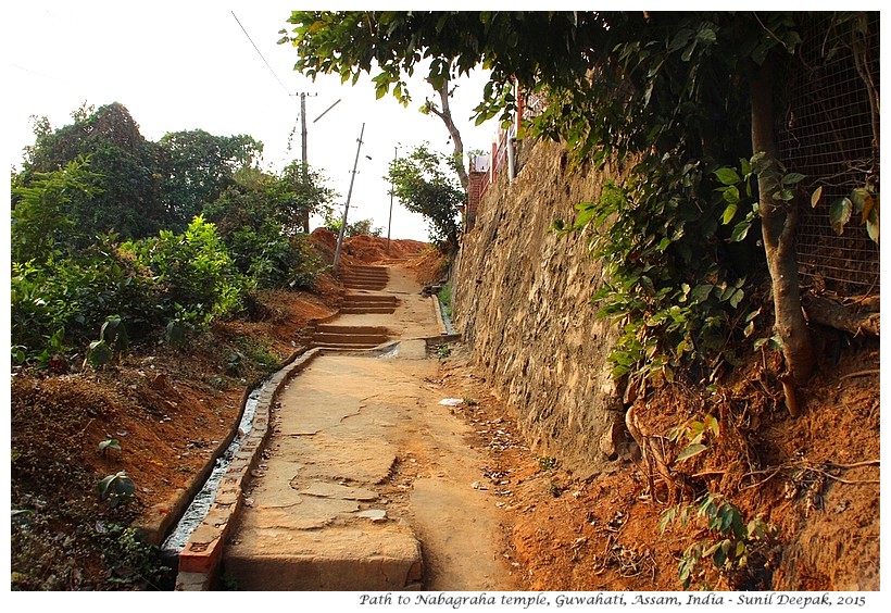
This walk is moderately difficult as it involves climbing on a hill. The road going up the hill is not very steep and has places where you can stop to rest and admire the panoramas of the city below.
Wear comfortable shoes and keep a water bottle and an umbrella to protect you from the sun. Along the way, there are some small shops selling soft drinks and snacks. If you are planning an unhurried and relaxed walk, keep at least 2-3 hours for it.
THE POND OF SILPUKHURI
Silpukhuri is a popular residential and commercial area of Guwahati close to Uzanbazar. It is separated from the Brahmaputra river by the Chitrasal (Nabagraha) hill. It is easily accessible by buses going towards Narengi and Chandmari. It is believed that in more ancient times, when Guwahati was called Pragjyotishpura, the ashram of sage Kannwa was located in the Silpukhuri area.
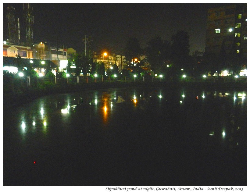
The round pond of Silpukhuri was constructed by the Ahom king Rajeswar Singha (reigned from 1751 to 1759). According to an old inscription, this pond was built in 1753 AD under the guidance of an officer called Tarun Duara Phukan and was originally a nine-cornered pond (as the pond of the Nabagraha temple) and was therefore called Na Kunia Pukhuri.
According to Mr Brahmananda Patiri, after becoming the king, Rajeswar Singha had come to Guwahati on a pilgrimage and his visit had resulted in the construction of three important temples in the city – Nabagraha temple, Bashistha temple and Monikorneser.
Today the pond and its surrounding garden are areas of calm and tranquillity even if the nearby road is full of traffic and noise. If you wish to go inside and take a walk around the pond, it has an entry fee of five Rupees.
WAR CEMETERY
To visit the Second World War cemetery in Silpukhuri take the Nabagragha road, opposite the Silpukhuri pond, going towards the hill. You will find the cemetery, a ten-minutes walk away on the right side of the road.
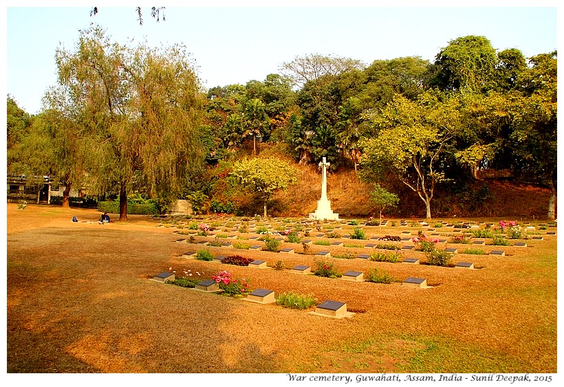
The war cemetery of Guwahati is relatively smaller compared to some other cemeteries of the north-east. It has the graves of Christian and Muslim soldiers while the Hindu soldiers were cremated and are commemorated by simple tomb stones and a monument.
This cemetery was initially started for burials from the several military hospitals posted in the area. Later, graves from other cemeteries in Assam and also from other NE states were brought here. For example, in 1952, graves were brought here from isolated sites in the Lushai Hills and from places like Cooch Bihar, Darjeeling, Lebong, Lumding, and Shillong.
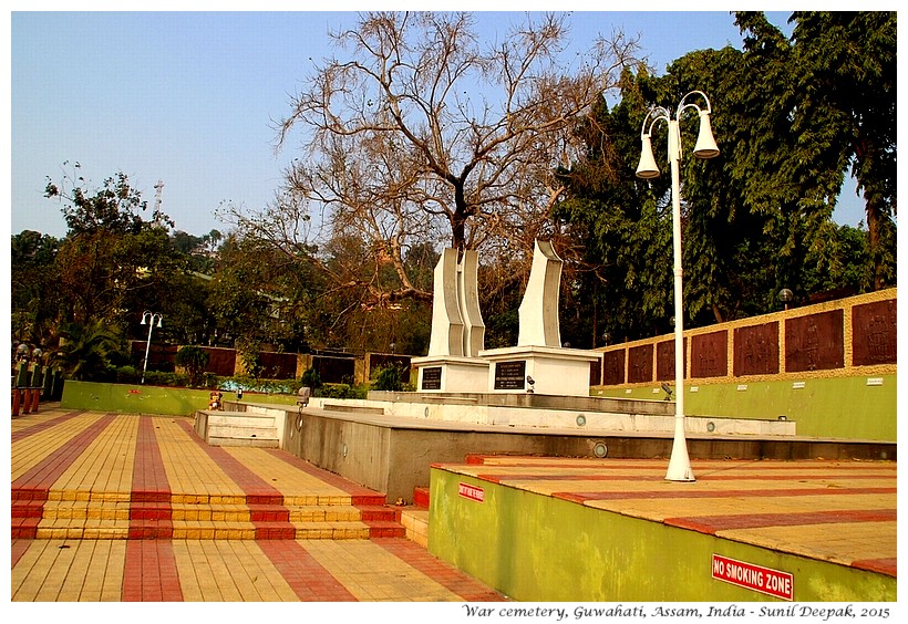
In 2012, a delegation from Japan had come here to exhume eleven Japanese graves. It is the only war cemetery in India that had the graves of Japanese soldiers. Were these the Japanese who had died during the war or they were the prisoners of war? I have not been able to find out more about the Japanese soldiers buried in Guwahati. Anyway, I like the idea that soldiers of the two warring sides can lie together in the same cemetery in eternal repose.
While visiting the war cemeteries of soldiers in the British army, I am always struck by the young age of so many of them – 22 or 23 years old boys, especially among the Indian soldiers.
If funerals and cremations interest you, just behind the war cemetery is the Hindu cremation ground of Silpukhuri.
NABAGRAHA TEMPLE
The Nabagraha (Naba = Nine, Graha = Planets) temple celebrates the nine planets of the Indian mythology. The temple is dedicated to Shiva. Inside the temple, a central Shiva lingam is surrounded by the nine Shiva lingams each representing a planet.
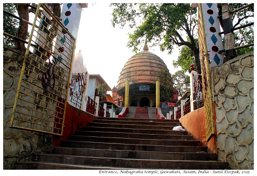
According to the ancient Indian knowledge of nakshatras (planets & stars), there are nine graha (planets) – Ravi or Surya (Sun), Soma or Chandra (Moon), Buddha (Mercury), Shukra (Venus), Mangala (Mars), Guru or Brahaspati (Jupiter), Shani (Saturn), Rahu and Ketu. Indian astrological charts usually mention the positions of all these nine planets for preparing the birth-charts of the individuals.
Except for Rahu and Ketu, the remaining seven planets of Indian astrology are familiar to us as the names of the seven weekdays. It is remarkable that the names of the weekdays in the west follow exactly the same structure and order. It could be that when the system of weekly organisation of days came to India, the names of the Western weekdays were translated into Hindi or Sanskrit. Or, it can mean that in ancient times, knowledge about these seven planets was shared across the known world. I am not sure about the chronology of the use of the seven-days' weeks in India and in the west.
On the other hand, according to the modern astronomy there are eight planets – Mercury, Venus, Earth, Mars, Jupiter, Saturn, Uranus, and Neptune. There used to be a ninth planet called Pluto, which was discovered in 1930, but this planet is small in size and according to the modern definition of planets, is no longer considered as a real planet.
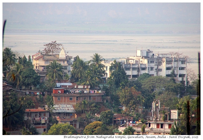
The Nabagraha temple built on the top of the hill, is set up on a raised platform, facing Silpukhuri. At the back of the temple, looking down beyond the trees and the buildings, you can see the mighty Brahmaputra river with its riverine islands and the beaches of pristine white sand.
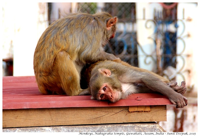
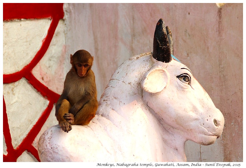
During my visit, the whole area was full of monkeys who were busy playing. They did not pay any attention to me. However, I was told that if you go there with bananas or other edibles, they can surround you or even snatch away your food.
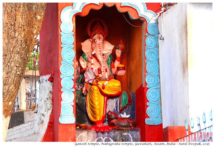
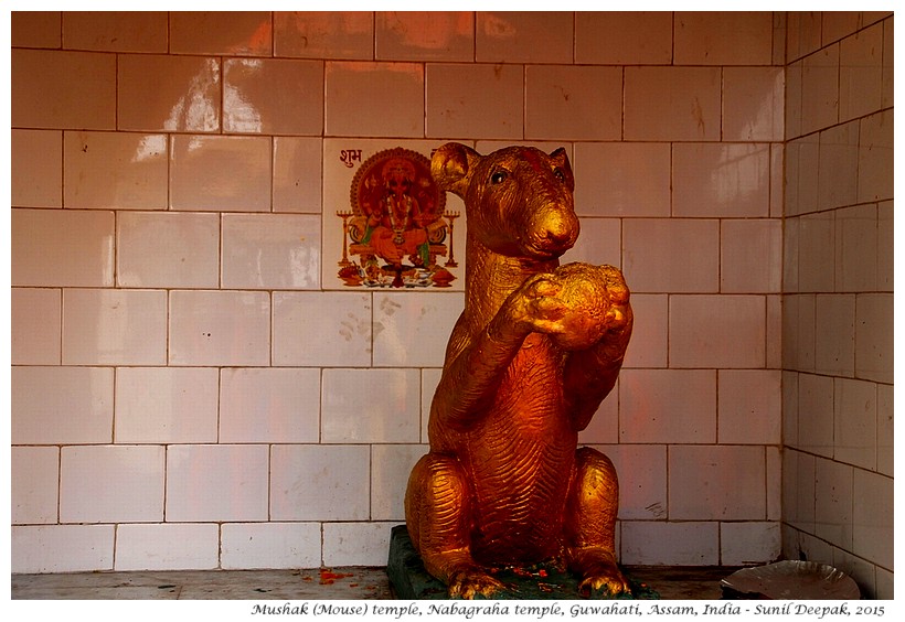
Below you will find some pictures of these smaller temples in the Nabagraha temple complex.
The climb from the bottom of the hill up to the Nabagraha temple, took me around 40 minutes. However, if you are in a hurry, it can be done much faster! If you do not want to climb the hill, you can also reach the Nabagraha temple in a taxi.
The path for walking to the temple is not marked but if you will ask, local persons will indicate it to you. The path passes in front of the houses built on the hill. All around you can see other hills with houses on different sides. Many houses in this area, especially those not very close to the main road, seem poor. The only way to reach them is through informal paths on the hill.
SERVICES AND CHALLENGES
Unfortunately there are no public toilets in the area, which is a pity since this means that men stand and piss behind the shops and some times even in front of the houses.
I can imagine the difficulties of the people living in those houses and those of the women pilgrims, in trying to find secluded places.
Some places near the temple were full of plastic bags and other garbage. Sometimes our love for the temples and the nature, does not translate into cleanliness, taking proper care of the garbage and having decent toilets!
CONCLUSIONS
The walk back was much easier and faster since it was downhill. There were not so many things to see on this walk, yet it was fulfilling as it brought together the elements of recent history, the sacred temple of Nabagraha, the panoramas of Brahmaputra river and the antics of playful monkeys.
As explained above, there is a partial overlap between the Indian planets used for astrology and the planets according to the modern astronomy. Some persons see this difference as a criticism of Indian systems of knowledge. However, personally I think that the ancient Indian knowledge was developed without the help of advanced telescopes and other technological instruments, so the understandings reached by ancient Indian astronomers/astrologers were remarkable.
Personally I am also intrigued by the Indian way of defining Rahu and Ketu as the planets which can “swallow” the Sun and the Moon. At one level, these two “planets” are mythological answers to explain the phenomenon of eclipses. However, this does not mean that there was no Indian knowledge about the physical explanation of the eclipses. According to a paper from Tata Institute of Fundamental Research, Aryabhat in 499 AD gave a formal theory of eclipses based on the transit of Moon between Earth and Sun and in the shadow of the earth. (Vahia and Subbarayappa, 2011 )
To conclude, here are the links to my earlier four posts about Guwahati – an introduction to Guwahati city; the cultural life in Guwahati; the Basistha temple; and, Nilachal hill and the famous Kamakhaya temple.
***

